The MCC is equipped with 4 antennas, two of which allow receiving space images, and the other two - service information from satellites and transmitting control commands from operators' workplaces on board. Students carry out management in an automated manner; if necessary, it is also possible to switch to manual control.
Student PCO works with real-life tasks. Among them: observation of the Earth from space, monitoring of outer space, studying space weather, conducting scientific and technological experiments in space, etc. The Center also hosts the Earth-satellite and satellite-Earth information exchange.
Student MCC is a part of the Youth Space Center (MSC) of the Moscow State Technical University, which is intended both for work on special projects and for the educational process. It hosts laboratory work for students from specialized departments, as well as classes with schoolchildren as part of the Step into the Future program.
Today we will tell you more about the Center and its current projects.
Operation of the Bauman MCC
The MCC operates on the basis of the DOKA-N ground-based radio-technical complex for remote servicing of the spacecraft (NRTK). It consists of antenna feeder devices, a rotary drive unit, 2 IC-910 transceivers and a personal computer.
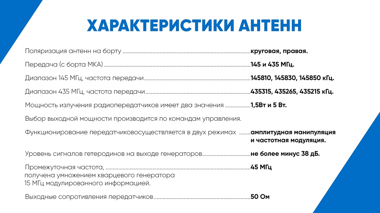
Radio communication channels of small spacecraft (SSC) with a ground control complex (GCC) are organized in two frequency ranges - 145 and 435 MHz, allocated by international regulations for amateur radio communications, and, in each range, in two directions: for transmission and for reception.
This allows both receiving information from satellites and transmitting various target tasks to them.
Receiving and transmitting equipment on board and the Earth is built according to the transceiver scheme - when the operation of the radio transmitter excludes the operation of the radio receiver of the given frequency range.
Within each range, communications can be organized in two-way simplex mode (duplex with switching), and when using different frequency bands in full duplex mode. To organize communication, taking into account emergency situations, three frequencies are used in each range: main, auxiliary and reserve.
In each frequency range, one common antenna is used, working either for reception or transmission. The switching of the antenna operation mode is performed in each transceiver (145 and 435 MHz) by means of electronic keys.
The possible average daily volume of information is determined by the transmission rate from the spacecraft, as well as the number and geography of the location of the ground receiving stations used and can reach several Gbps.
If the volume needs to be significantly increased, then additional equipment of the small spacecraft will be required with a specialized highly informative radio link for dropping research information, integrated with unified ground receiving stations such as UniScan and POLUS.
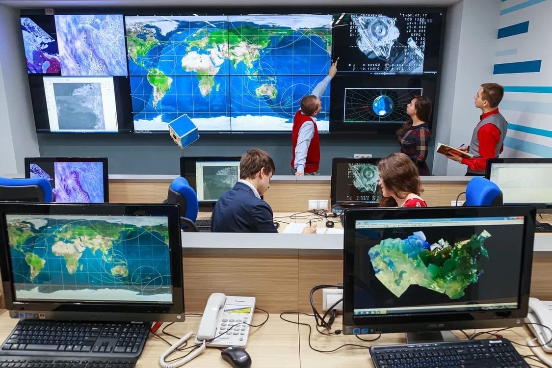
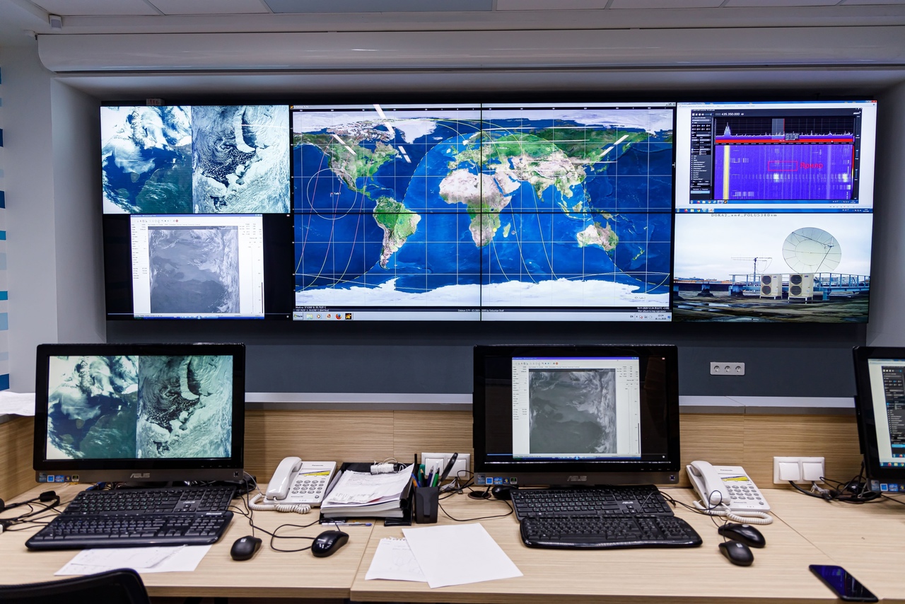
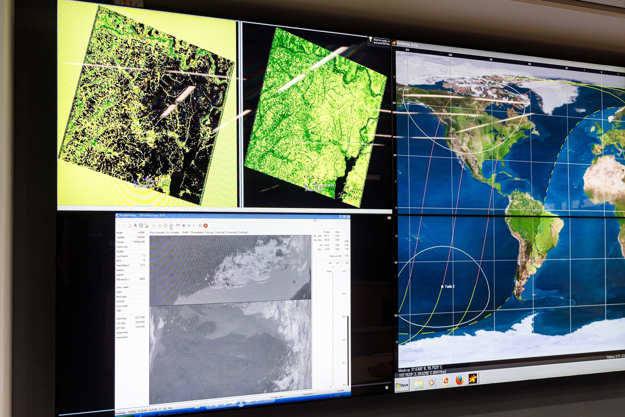
After receiving data by the receiving station, the information is automatically transmitted to the receiver, which is located in the MCC itself. From the receiver, in turn, the information is transmitted to the computers of the Center, after which the data are processed by various programs and, if necessary, are displayed on large screens for further discussion of the results obtained.
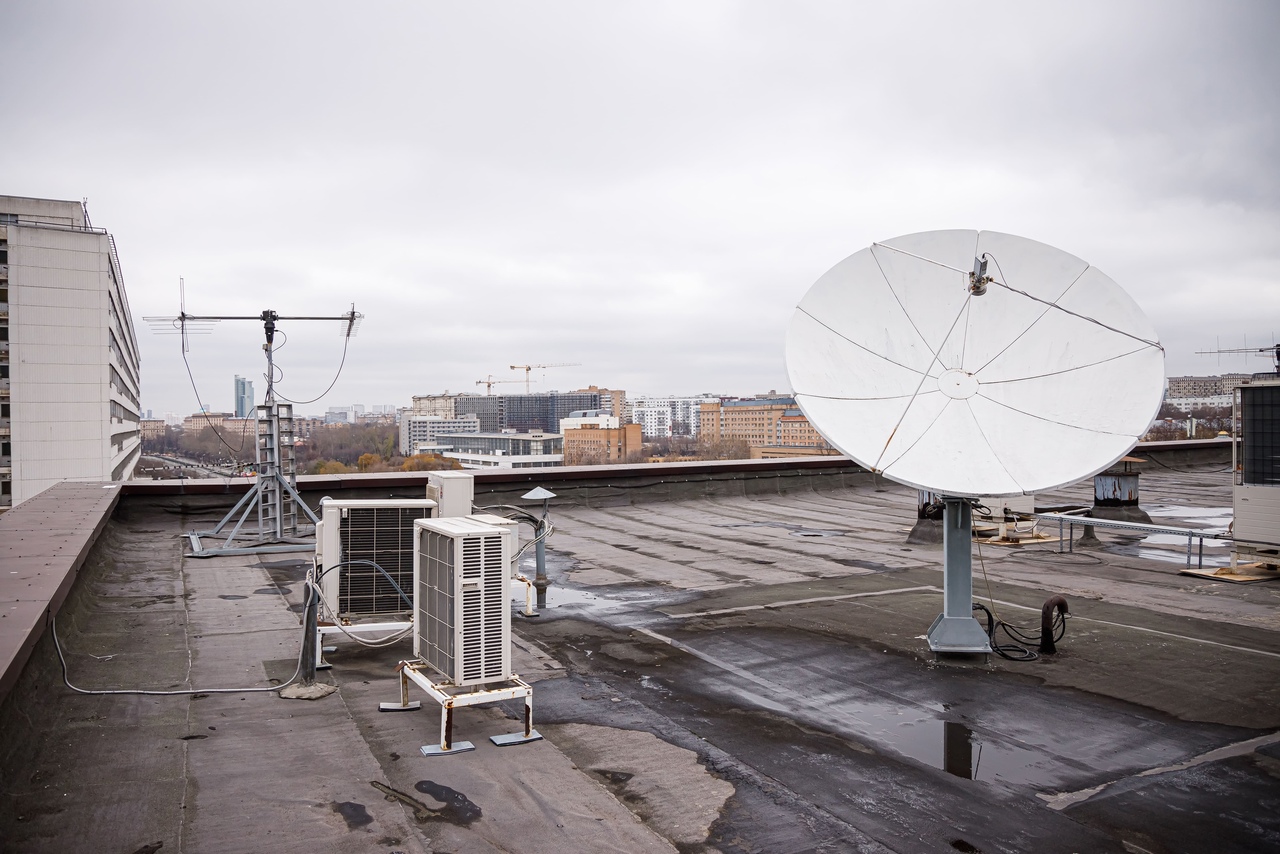
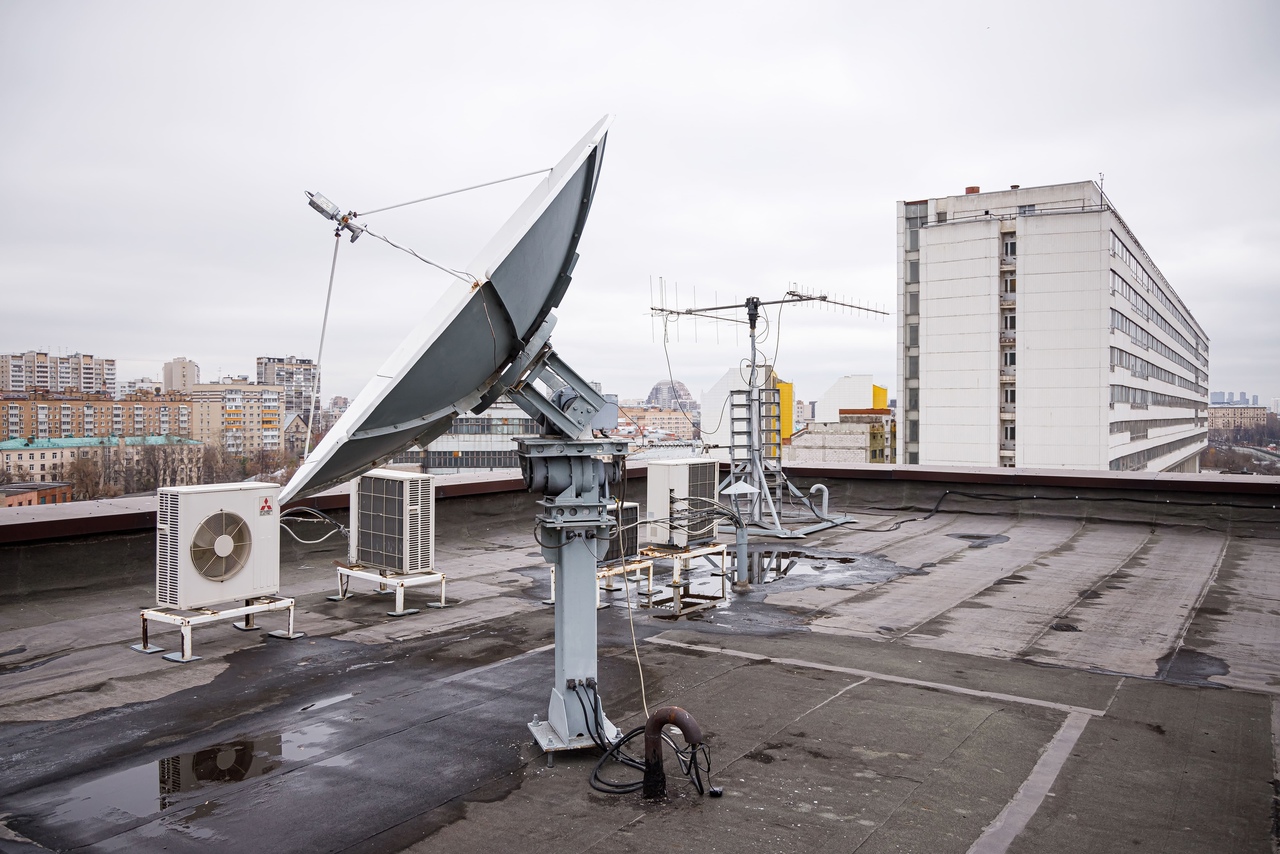
Ground receiving stations. They are antennas
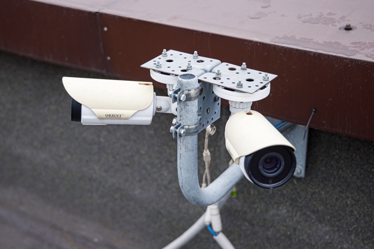
Ground receiving stations are installed right on the roof of the building of the Faculty of Special Engineering, in other words - antennas, the possibilities of which were mentioned above. Thanks to them, communication with satellites is carried out. Students can observe and control them directly from the MCC, because cameras are installed on the roof, which transmit images in real time to the computer screens of the Center.
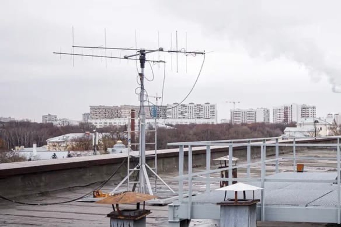
The "wave channel" antenna shown in the photo below operates at a frequency of 135-435 MHz. It serves for receiving and transmitting telemetry. The signal is received by antenna "antennae", each of which corresponds to the frequency multiple of the wavelength to which it is tuned. Their number depends on the characteristics of wave reflection, which ultimately allows you to amplify the signal.
The directional angle of such an antenna is 30 degrees, which allows you to "capture" a larger view for connecting communications with satellites. The gain of such antennas is 10-15 dB.
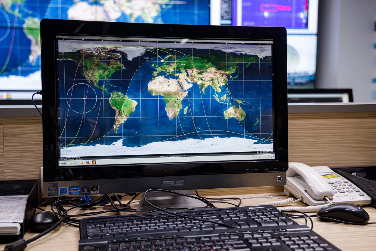
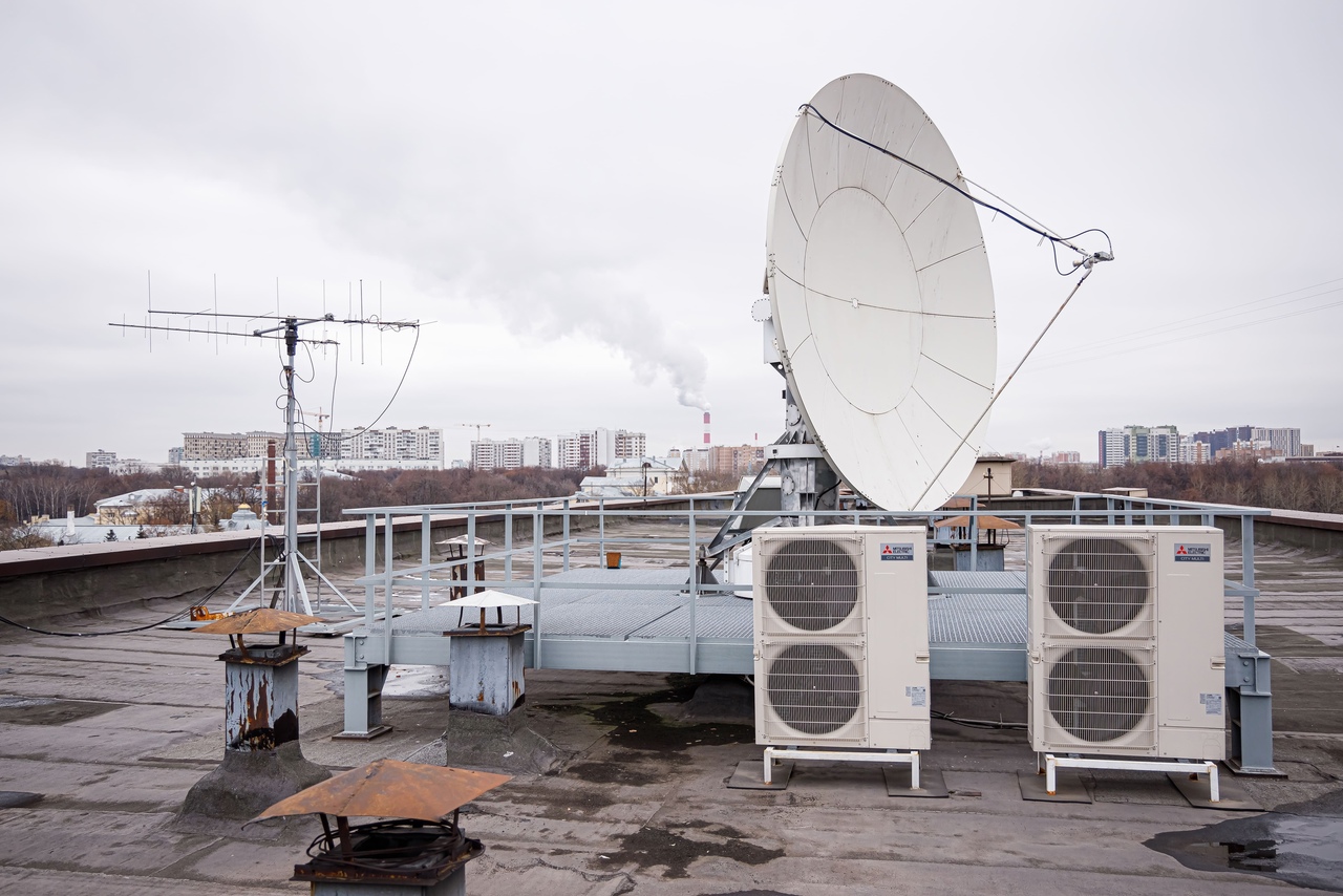
Other types of antennas allow you to receive more information from satellites. The diameter of the POLUS antenna is 3.8 m, and the Uniscan-24 antenna is 2.4 m. Thanks to the special Orbitron program, it is possible to control both antennas and obtain information about the position of different satellites at different intervals.
Antennas of this type operate at frequencies of 8 GHz. And high rates of frequency of work allow you to receive information at higher speeds.
The principle of operation of the antenna is that all incident waves are received by the parabolic plane, after which they are reflected to the focal point, where the feed is located.
The directional angle of such an antenna is 1.3 degrees, that is, to read information from satellites with such an antenna, it is necessary to clearly know the trajectory along which the satellite is flying. The gain of such antennas is 47 dB. They are used in the MCC to receive remote sensing information.
Earth remote sensing (ERS)
To increase the functionality of the MCC, it has deployed the Earth Remote Sensing (ERS) Space Information Receiving Center based on ground stations.
The ERS Center was created to obtain full-fledged scientific data in the field of studying the Earth from space using advanced instruments and methods. In addition, students are trained here in the skills of operational reception of satellite data and processing of images of the earth's surface obtained from various ERS spacecraft - Aqua, NOAA, Terra and others. In laboratory work, students of specialized departments (CM1, CM2, CM3) independently receive information and process it for further scientific research.
At the educational site of the ERS Center, thematic classes are held for students of specialized schools: lectures on space monitoring, master classes and various workshops. Schoolchildren attend a communication session with real Earth remote sensing satellites, participate in the reception of space images and their preliminary processing.
During the entire existence of the ICC, students have designed 3 satellites for solving remote sensing problems: Baumanets-1, Baumanets-2 and Baumanets-3.
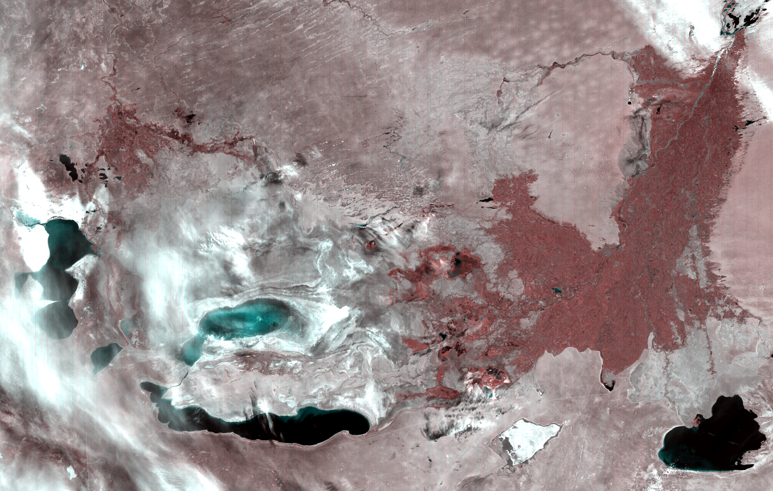
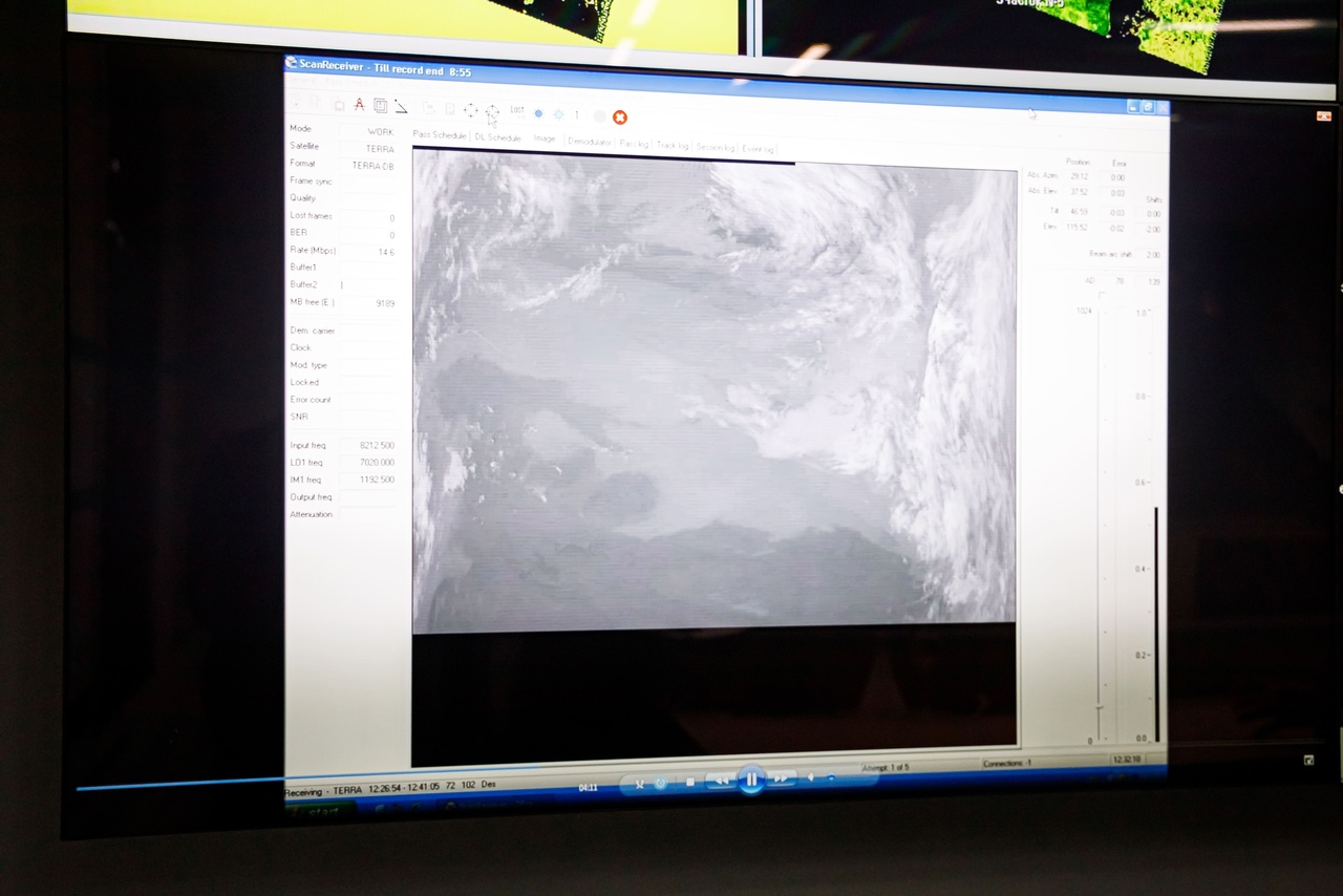
The work of such satellites can also be monitored from the student MCC. The equipment of the Center allows to demonstrate a certain black and white picture. It looks like this due to the fact that it conveys a large amount of redundant information. The image appears and is updated in real time. New information from a scan of the Earth's surface is constantly displayed on the screen.
In the next step, the image is analyzed. Having received information about the various components, the computer processes the data, leaving only the necessary filters and settings. As a result, a completely different color image is obtained, showing specific research results and specific features. This can be: studying the underwater world, obtaining data on the state of the forest, identifying minerals on the surface. That is, the ERS Center allows the Bauman people to receive real data about the Earth from space and learn from real tasks.
One of these tasks is to investigate the ice situation: depending on the weather on the Northern Sea Route, the ice grasps in different ways, and there are some territories that are more profitable to bypass from different sides (to the north or south). Remote sensing allows you to choose the most suitable route for a caravan of ships.
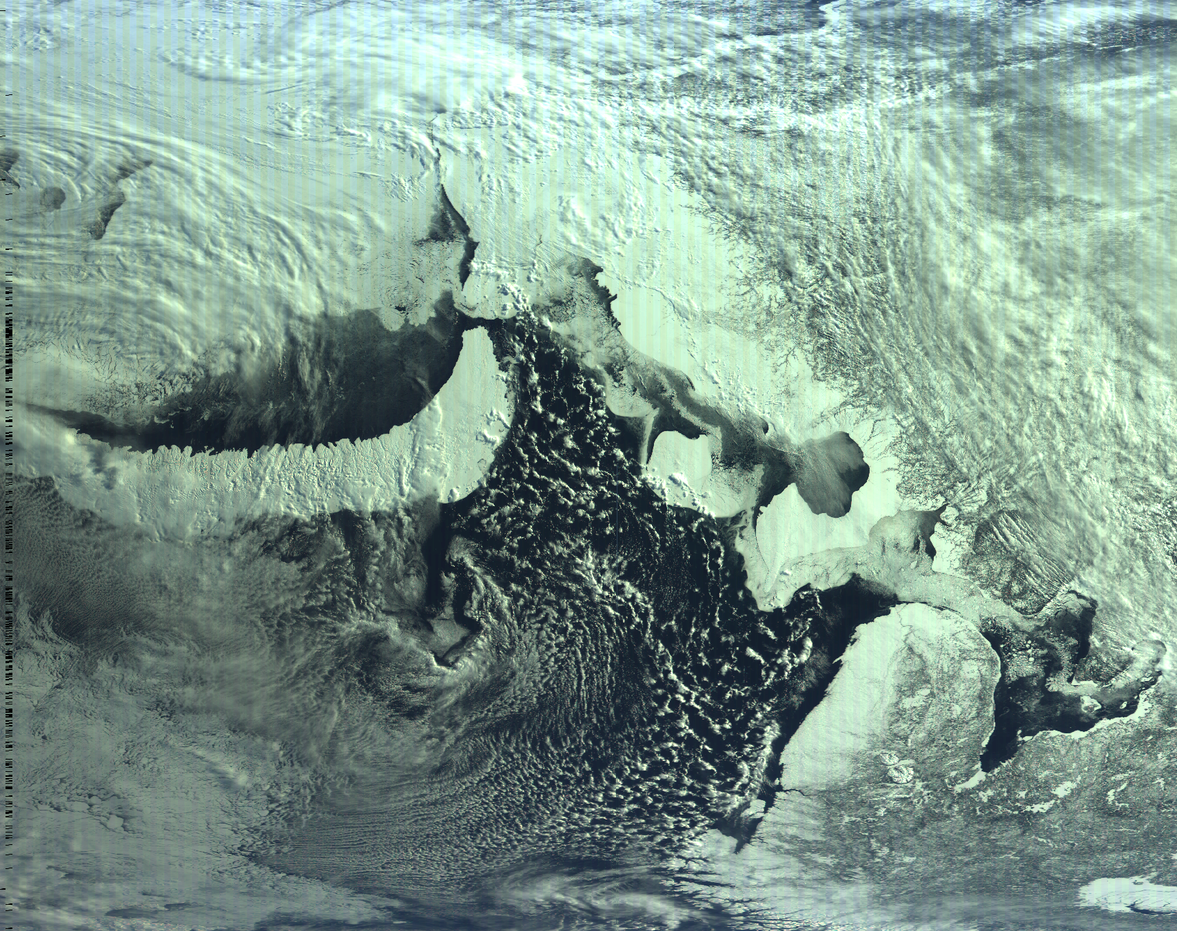
Recently, remote sensing technology was used in the process of solving the situation with the ecological situation in Kamchatka. Despite the cloudiness, space radar images were obtained for further examination. They are used as maps of pollution distribution for a particular sea area, which helps specialists in their work.
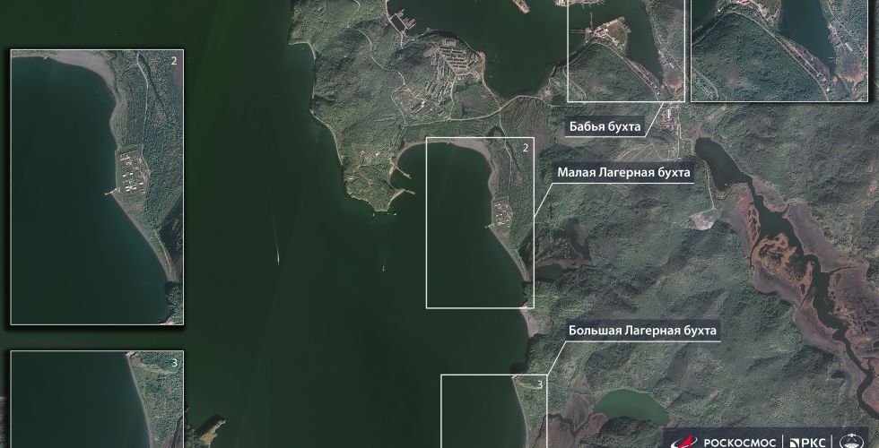
Image from the site roscosmos.ru
In the next article, we will tell you about the Bauman satellites Yarilo-1 and Yarilo-2, which were successfully launched into space on September 28 from the Plesetsk cosmodrome by the State Corporation Roscosmos under the UniverSat program on the Soyuz- 2.1b "as a passing load. Stay tuned and don't miss new interesting materials!