Below, I - cartographer Alexander Pronin - will tell you how, together with my colleague Nikita Slavin , a map of the age of the houses of the city of Vladimir was created .
Data
For the layer with buildings, I used the download from the OpenStreetMap site . This layer contains the address, which is divided into columns, the name of the object and the number of storeys. I collect data on the year of construction, address, name of the object and photos from several sources.
The first is my site vladimirdom.rf - a building map. I created it in order to show the residents how our city was built up. For her, I took data on the year of construction from the website of the Ministry of Housing and Communal Services , for kindergartens and schools - from their official websites. A lot of data for the year was sent by card users. The map only shows the year of construction.
The second is cadastral data . I am interested in capital construction projects. Many have the year of construction and address indicated.
The third is the open data site of the Ministry of Culture . We need objects of cultural heritage. From it I collect data on the name of the object, address and photo.
The fourth is the wikimapia.org website . There is a name of the object, an address and a photograph. After collecting the data, we start processing them.
Geoprocessing
To process the data, I used the MapInfo program. For data conversion - Excel. The ultimate goal is to collect all the data on one layer. I start with the building layer from the OpenStreetMap download. I upload data to an Excel spreadsheet to combine data with an address from different columns into one. I use the link function. I load the file from Excel into MapInfo and put down the resulting address by a unique value. We get a layer in which the addresses are correct and the number of storeys is indicated.
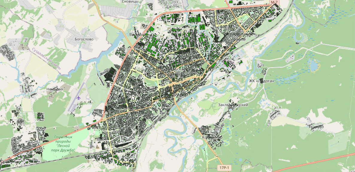
OpenStreetMap Layer
. MapInfo . « » , .
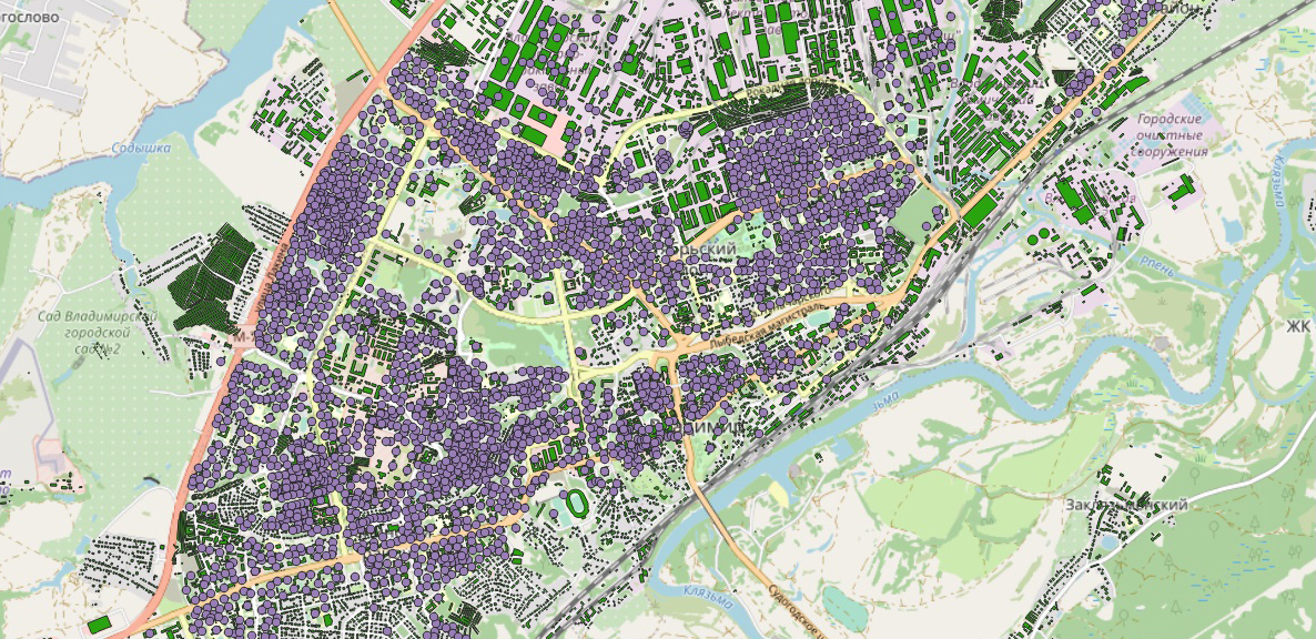
OpenStreetMap + .
OpenStreetMap +
OpenStreetMap +
OpenStreetMap + wilimapia.org
Excel . , , , . ., .
wikimapia.org, . , , wikimapia.org. MapInfo . :
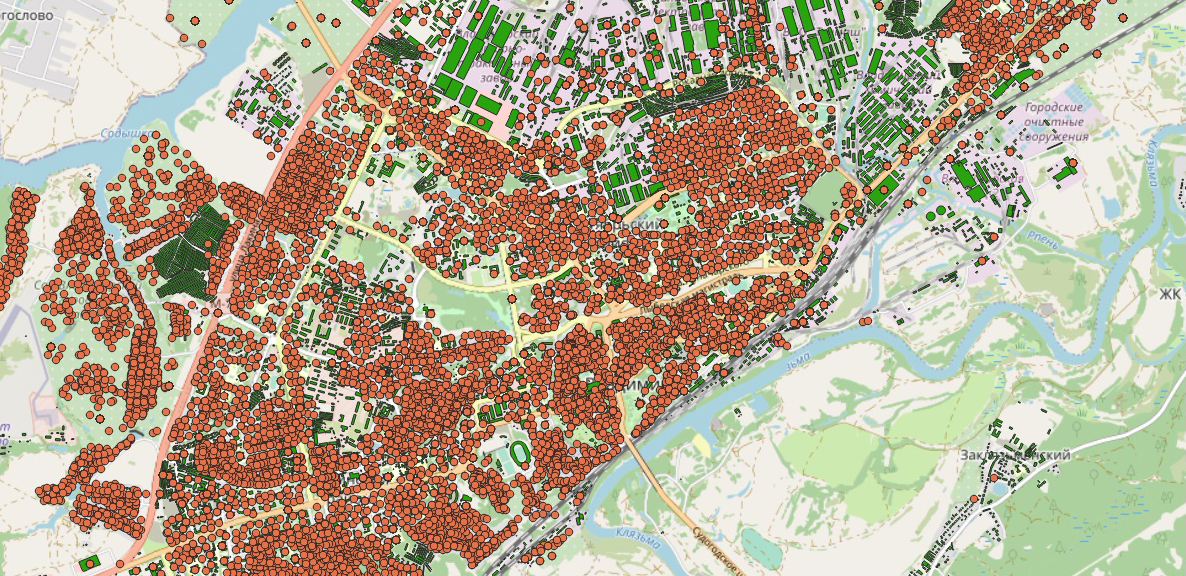
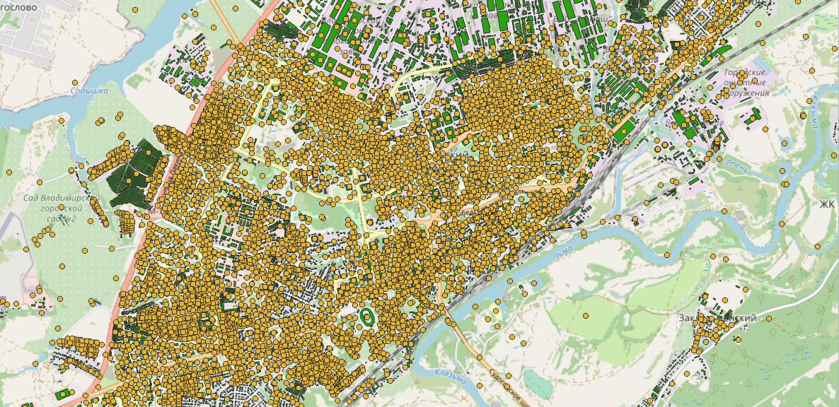
21429 , 8017 .
– , —
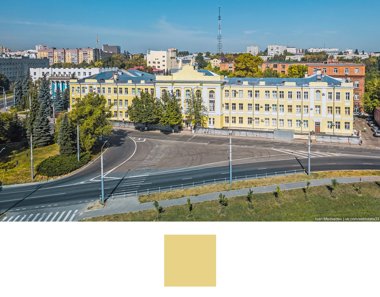
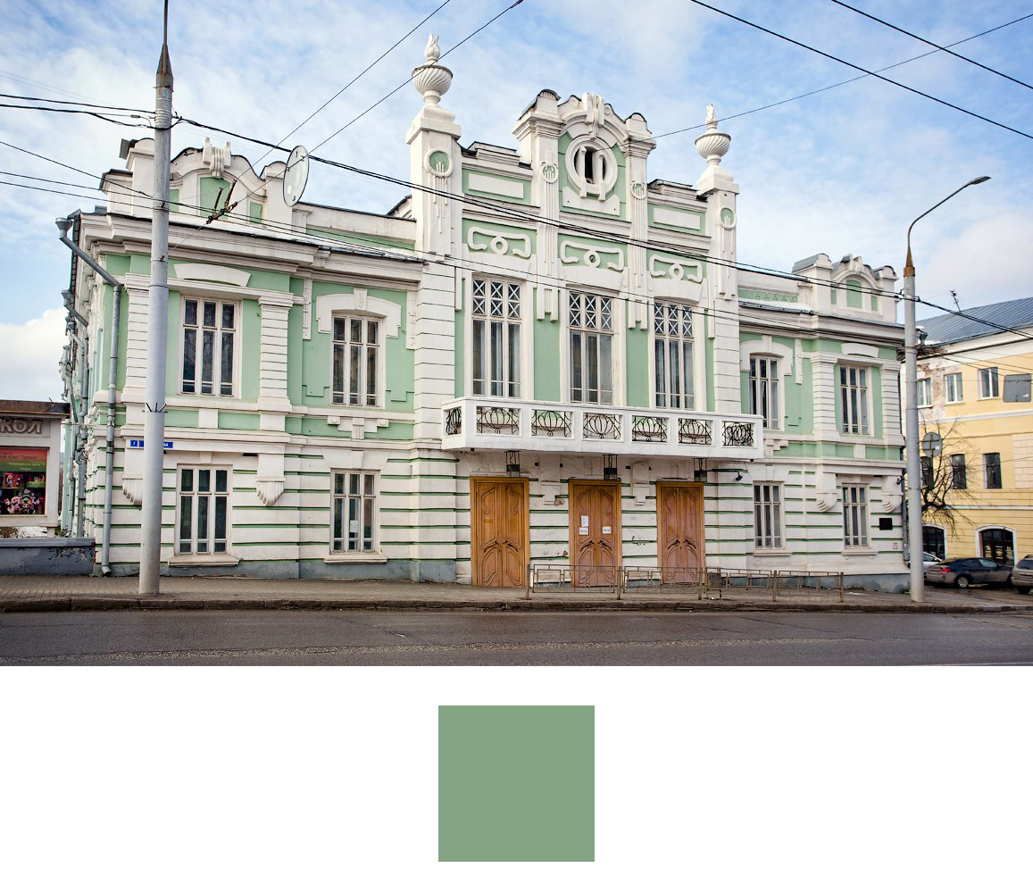
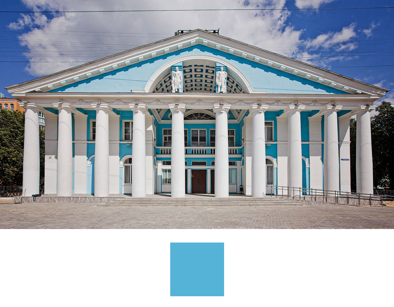
, , , 1917 .
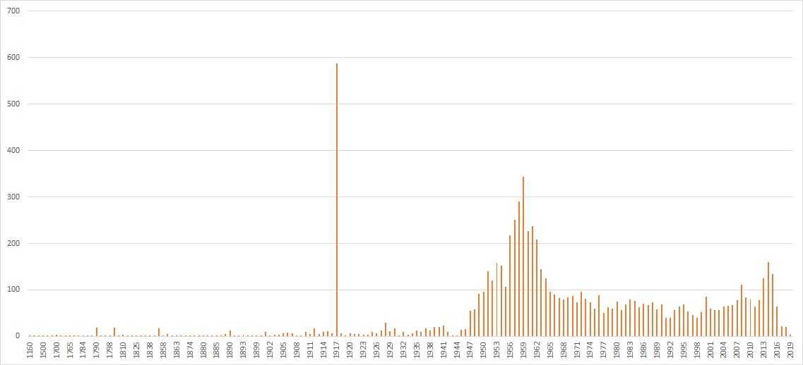
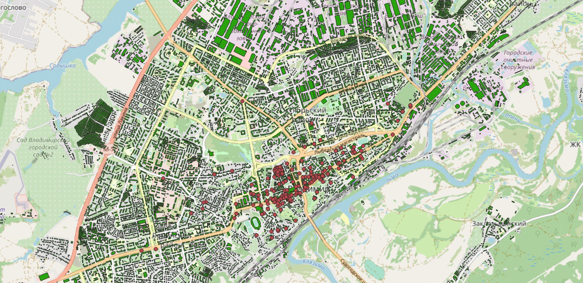
, . , . .
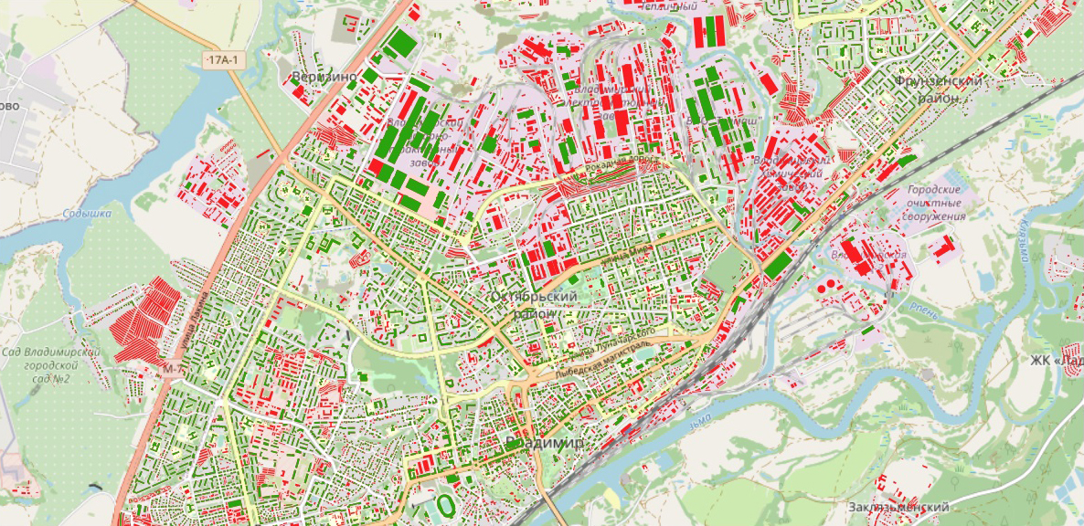
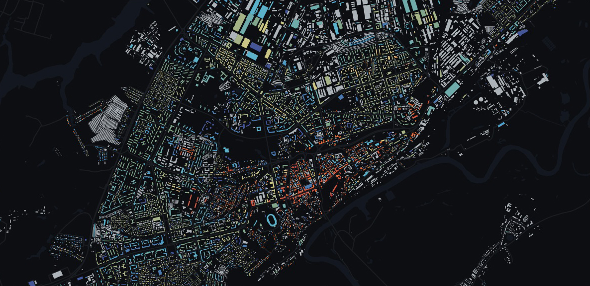
QGIS. , , . CartoDB Spectral, QGIS.


QGIS . 3 : , .

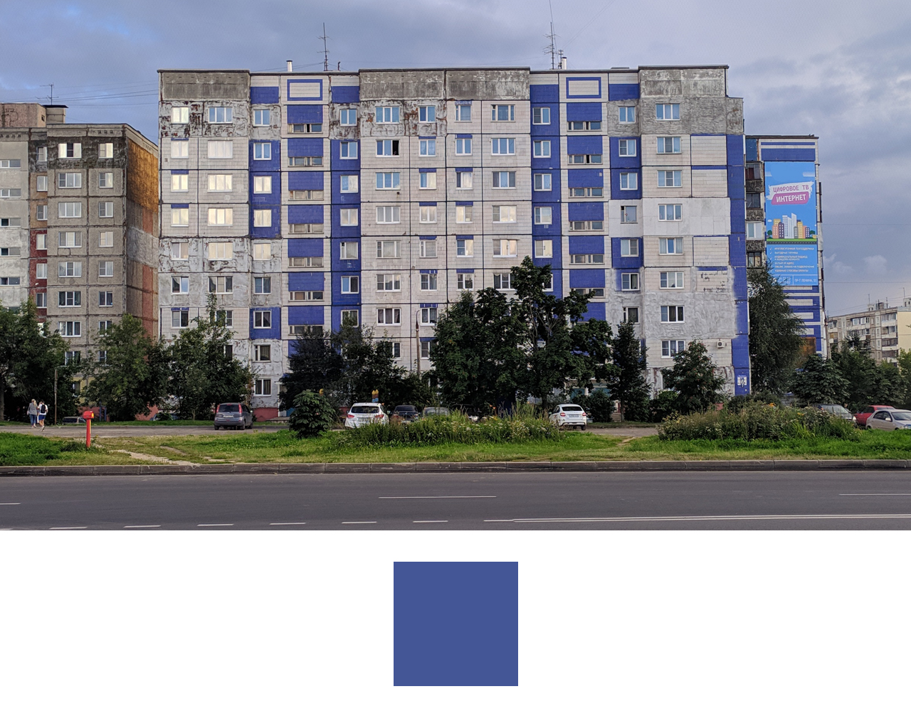
. 1900 , . 1900 2000 , . .
, , «». . , .
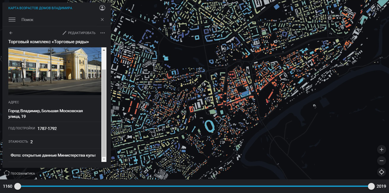
«» , .