However, carrying your phone with you will make it much easier for rescuers to find you, and HackaDay user Eric is developing a tool for this job.
The portable version of the ResQ is equipped with a directional wave channel antenna to help pinpoint the direction to the signal location.
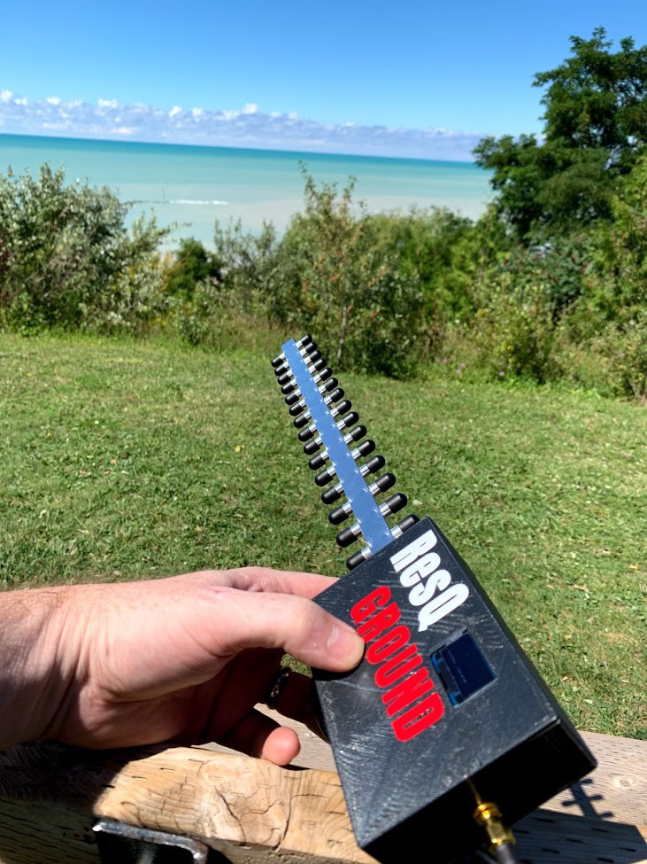
Eric's project is called ResQ and is designed to find lost travelers by detecting beacon packets from a mobile phone's WiFi adapter. The project comes in two forms - a handheld device with a directional antenna and a drone-mounted device to search for signals from a WiFi phone when flying over terrain.
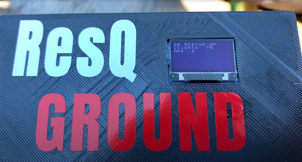
ResQ is built on top of the ESP8266, which is a cheap and affordable way to build a custom WiFi scanner. The system can now help rescuers find missing persons by detecting Wi-Fi devices and writing MAC addresses along with timestamps and GPS location data to an SD card. Future plans of the author of the development provide for the addition of a communication line with the drone so that rescuers can see the detected WiFi devices in real time.
There are similar commercial systems that mostly work with GSM signals rather than WiFi. The cost of such equipment is prohibitive for many organizations, so we can see ResQ as a useful tool to fill the niche of available systems.
The author was inspired by the North Woods Law TV show about search and rescue operations to develop the search engine. The TV show participants struggled every week to find lost people in the remote and rugged areas of Maine, USA. Cellular communications are often unavailable in these areas, but in almost every case, the people being rescued had working mobile phones. The author lives in Canada, where many of these situations also occur in their vast wasteland. The author suggested that he could use an external 2.4 GHz antenna to receive beacon packets from these phones and record this data.

The developed system can be integrated into any very small drone or radio-controlled aircraft. It can also be installed on existing aircraft participating in the search.

The use of a small unmanned aerial vehicle (for example, the Nano Talon, which the author uses), compared to manned aircraft, offers such advantages as wide adaptation to flight conditions, flight altitude, terrain, time of day, etc. Drones can also be sent to a given point automatically and tracked in real time from any ground station.
The functionality of the developed system:
- Detects all beacon packets, their RSSI and MAC addresses
- Detects all WiFi hotspots within range (not required to search, but registers them anyway)
- Get drone location by GPS
- Get GPS time in UTC
- Writes all of the above to the CSV file of the SD card every time it detects a change.
- Displays the number of discovered clients, discovered access points, time and latitude / longitude on the OLED screen in real time.
- Sending telemetry to a ground station via LORA (currently in final development)
- Launching an external camera module to acquire an image (useful for searching with aircraft / drones - in development)